Ground Penetrating Radar [GPR]
GPR, short for “Ground Penetrating Radar” is an imaging technology used for subsurface earth exploration. All Proceq GPR systems use a stepped frequency continuous wave (SFCW) antenna that emit a modulated frequency between low and high to detect deeper target while not losing image resolution.
GPR uses electromagnetic wave propagation to image and identify changes in electrical and magnetic properties in the ground. GPR systems are used:-
- to locate underground utility services
- to locate reinforcement and post tensioning in concrete
- to monitor airplane runways for structural integrity
- to conduct groundwater studies
- to detect unexploded land mines as well as forensic research and surveying land for construction purposes
The Proceq GPR and its iPadOS Apps allow users to take written or text notes, voice notes and photos during data collection. On the scan images targets can be annotated during the scan and the images sketched on. All this added information is available on the Workspace cloud service, included with Proceq GPR products.
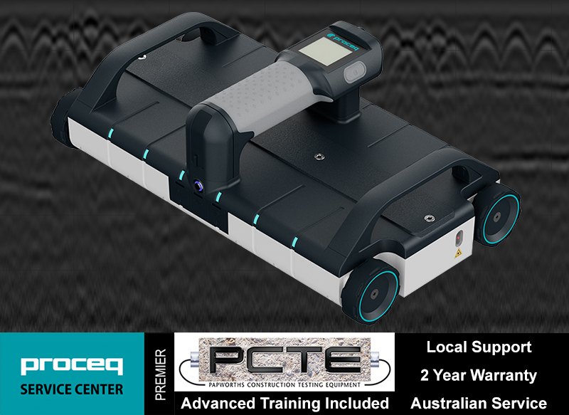
Proceq GP8000 - Concrete Scanning GPR
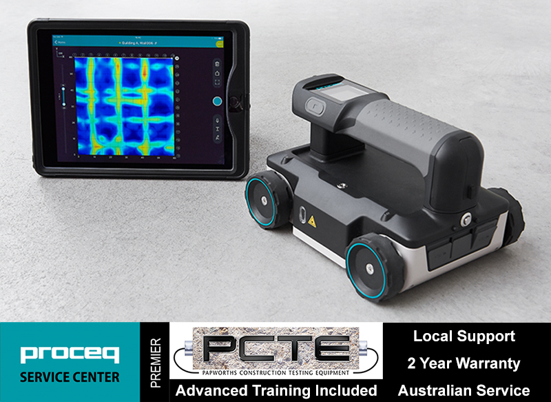 Proceq's GP8000 is the beginning of revolutionary concrete Ground Penetrating Radar (GPR). The high traction four wheel design with laser light guidance allow the user to locate and mark target easily and seamlessly.
It can scan up to 700 mm depth or deeper depending on the structure design and geometry, exceeding the maximum depth of other GPR in the market.
The Proceq GP8000 is a powerful and all-rounder GPR that fits most scanning applications on concrete structures. It allows you to “see” what others can’t “see” and provides more comprehensive inspection for better evaluation.
Proceq GP8800 - Concrete Scanning GPR
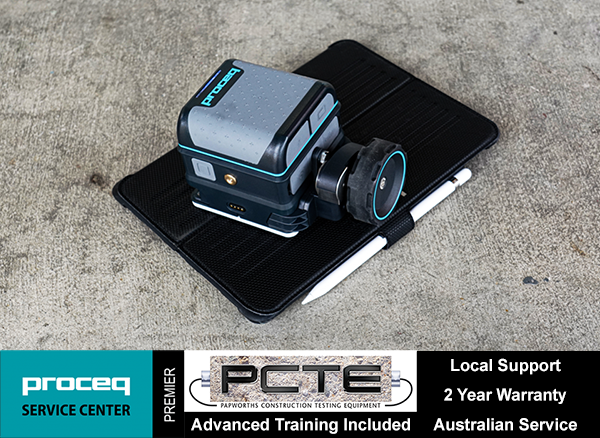 Proceq's GP8800 is the second generation stepped frequency continuous wave (SFCW) Ground Penetrating Radar (GPR) for concrete scanning, and the smallest probe size in Proceq's range.
The smaller probe with single wheel will fit within your palm and scan between edges and under tight spaces or into corners. The compact design of Proceq GP8800 enable it to scan beams and columns easily and detect the reinforcement.
With a frequency range between 400 and 6000 MHz for sharper image resolution and the single wheel encoder can rotate 90 degree for cross polarised scans, combined these features are great or longitudinal targets, location of second or third layer reinforcement, and identify the back wall.
Proceq GP8800 provide superior scanning capabilities to users with specific applications, at areas where no other GPR can reach. It increases the capabilities for engineers and inspectors to inspect concrete structures that was previously not possible with conventional four wheel GPR.
Proceq GP8100 - Concrete Scanning GPR
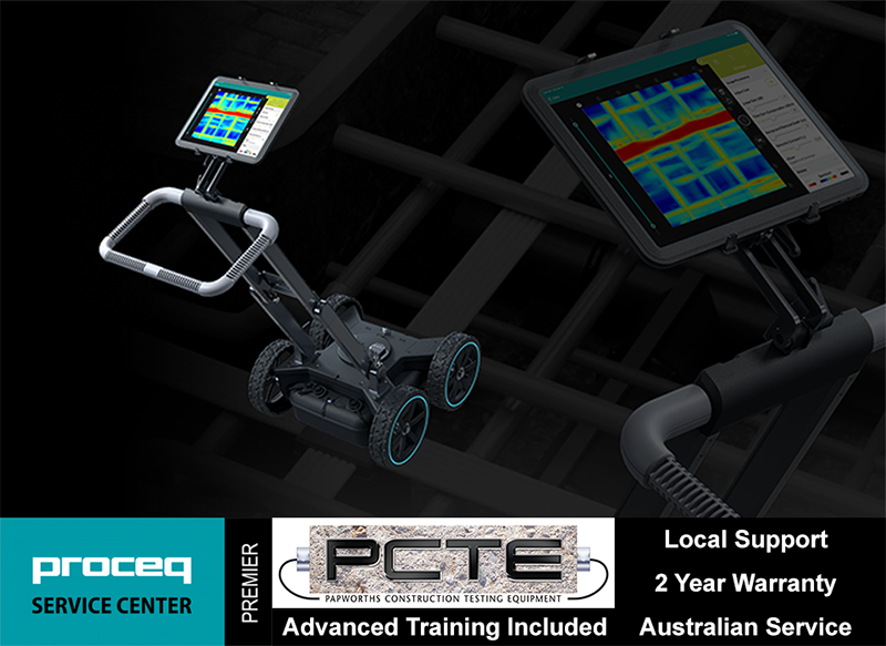
 Proceq's GP8100 is an array GPR with six antennas, that perform six parallel scans in one go. It has frequency range between 400 and 4000 MHz that can detect deep targets without losing image resolution. It can scan up to 700 mm depth.
The superline scan view provide second to none image quality that help user to identify targets easily and spot any misalignment in rebar layout. This is particularly useful for engineers and inspectors in detecting multi-layer reinforcement on floor slabs and post tension ducts on bridge.
The GP8100 is useful for large area scan such as floor slab, parking lot and bridge deck. There is no faster way to produce a 3D visualisation of a structure's reinforcement and embedment.
Proceq GS8000 - Utility Locating GPR
 Proceq's GS8000 is a utility locating Ground Penetrating Radar (GPR) that is used to locate services underground. It uses stepped frequency continuous wave (SFCW) that range between 40 and 3440 MHz, that can scan up to 10 meters deep and detect target down to 10 mm in size.
Additionally, the GS8000 system comes with a GNSS receiver that is RTK compatible.
The ultra-wideband radar technology enables utility locators to identify and detect targets easily, while increase their capabilities on utility mapping and surveying.